
Restoring the Thunder Bay River Watershed, Creek to Coast
The health of Lake Huron is tied directly to the water flowing into it.
Three major restoration projects on tributaries of the Thunder Bay River in 2021 reconnected 39 miles of coldwater habitat and significantly reduced the amount of sediment and other pollutants entering Lake Huron from one corner of the watershed in Montmorency County.
A timber bridge now stands where Carter Road crosses Gilchrist Creek southeast of Atlanta. Twenty miles upstream at Greasy Creek Road, a new bottomless arch culvert allows brook and brown trout access to vital spawning, nursery and refuge habitat. Both structures, installed during the summer of 2021, address long standing issues with erosion and virtually eliminate the risk of road washouts on one of the highest quality tributaries of the Thunder Bay River.
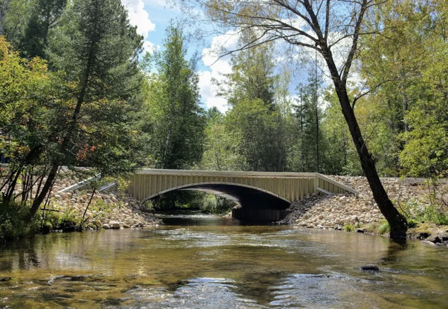
The restoration of the Gilchrist Creek crossing at Greasy Creek Road. (Use slider to see before and after.)
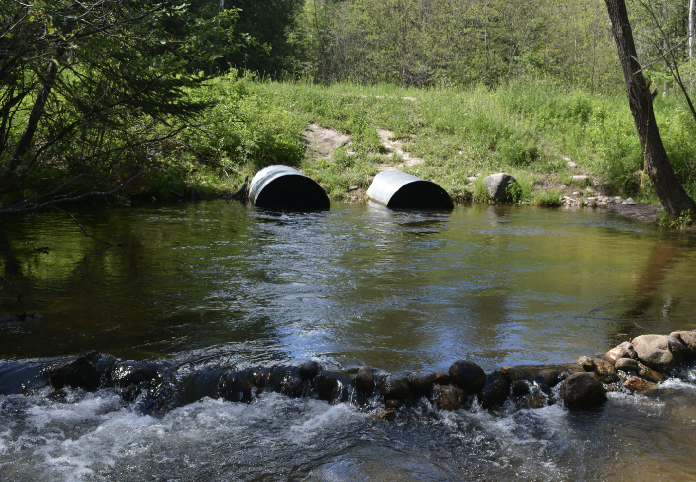
Huron Pines also installed a timber bridge where nearby Schmallers Road crosses Hunt Creek, reconnecting another 10 miles of upstream habitat by replacing three undersized culverts which were a bottleneck in the river and a velocity barrier for fish. Hunt Creek flows through a large tract of state forest and has deep ties to Michigan’s fishing history as the former site of Hunt Creek Fisheries Research Station. For 70 years, researchers at the remote facility experimented with fish stocking and population survey techniques on Hunt Creek itself, shaping strategies still in use today across Michigan and parts of the Midwest.
All three projects have reconnected vital spawning and refuge habitat for fish and other river life, a crucial countermeasure to a changing climate bringing more extreme temperatures, drought and storm events. These restorations also greatly reduce the amount of sediment, gravel, road salt and motor vehicle oils washing into the Thunder Bay River.
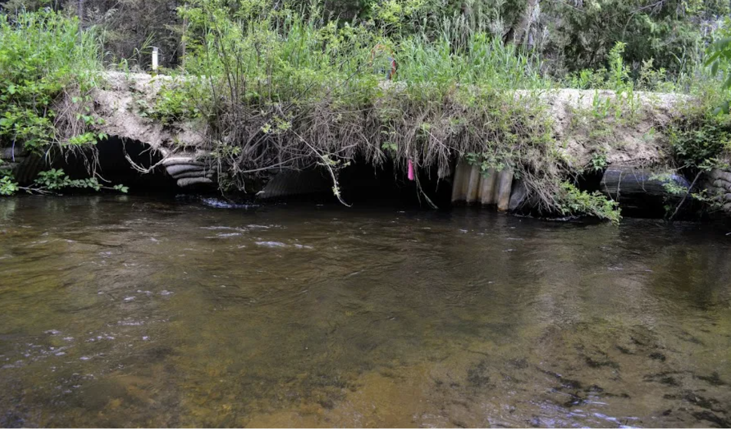
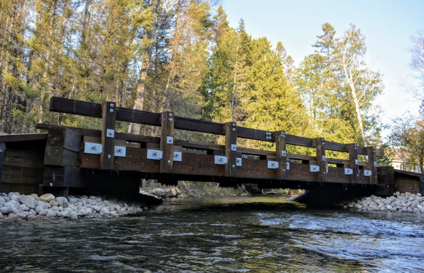
Three undersized pipe culverts at Hunt Creek and Schmallers Road were replaced with a timber bridge. (Use slider to see before and after.)
“Everything we do in the upper watershed has a direct impact on Lake Huron itself,” said Senior Project Manager Josh Leisen. “These were three high-stakes projects and it’s awesome to see their ecological benefits realized.”
Restoration of this part of the Thunder Bay River Watershed began in 2020 with the installation of a timber bridge over Gilchrist Creek at Harwood Road. A fifth project is planned at Hall Road on the Main Branch Thunder Bay River in 2023.
Funding for these projects come from the Great Lakes Restoration Initiative through the National Oceanic and Atmospheric Administration (NOAA), the U.S. Fish and Wildlife Service’s National Fish Passage Program, Great Lakes Fishery Trust and Walters Family Foundation. Montmorency County Road Commission provided in-kind labor and equipment.
Assessing Alpena’s Stormwater
Where the Thunder Bay River meets Lake Huron in Alpena, Huron Pines has completed a stormwater assessment to help community leaders improve the ways in which the port city manages its stormwater runoff, a move which will benefit Alpena and Lake Huron well into the future.
Stormwater is rainfall and snowmelt that runs over land and drains into nearby bodies of water, picking up and transporting pollutants such as fertilizer, salt, oils, sediment and litter which can result in beach closures, harm fish and wildlife, and trigger algae blooms.

A rocky Lake Huron coastline near Alpena.
Throughout 2021, Huron Pines digitized and mapped Alpena’s stormwater system, including drains to the river and Lake Huron, then estimated how much runoff and potential contaminants are entering those systems annually. This information will be used to identify problem areas where man-made or nature-based infrastructure solutions could make the most impact in capturing stormwater and contaminants before it enters Lake Huron, the source of drinking water for 10,000 people in Northeast Michigan’s largest city.
Solutions could include green stormwater infrastructure like rain gardens, bioswales, tree trenches and urban tree canopy improvements, all of which can improve aesthetics, support local tourism and recreation and build community vibrancy.
“The stormwater assessment will guide us through some brainstorming sessions with city staff and other community partners this year,” said Water Program Director Samantha Nellis. “By the end of 2022, we hope to have a plan with some engineering designs ready to implement. Stormwater assessments like this one are a powerful tool for leveraging grant dollars for on-the-ground work.”
The stormwater assessment is supported by the Community Foundation of Northeast Michigan, Northeast Michigan Youth Advisory Council and Michigan Department of Environment, Great Lakes and Energy.
This piece originally appeared in our 2021 Annual Report, published April 2022.